|
|
|
Pindari Glacier 1982 Pindari Glacier 2015 |


Prologue
Since 1980 we have started participating trekking program on a regular basis. Two years later we formed one trekking club named "Trekkers Anonymous". The members were mostly employees of Bank of India and some were friends of us. After the formation of the club our activities continued for another 3-4 years and then due to professional occupation and family obligation the activity stopped totally after 1988. Now all the members have already been retired from service life. So the very idea of trekking has again started brewing for quite some time amongst us. But We were not sure about whether we could make it. We were fumbling and in a dwindling situation whether to go ahead or not. Talks were mostly one to one. Our good old friend Pijush was of course the main person who used to raise the issue from time to time in our gatherings. But in most occasions the discussion was not heading to any definite shape. This year again the issue came up and this time it was when we were on a trip in Eastern Himalaya near Darjeeling. Ten of our members participated in the program. When the discussion about revisiting Pindari Glacier (our earlier programme was in 1982) came into floor , five of us were straight forward in declaring their inability due to lack of fitness , medical ground etc. The rest five without much fanfare meekly nodded to go ahead ………. So it was Pijush who blew the whistle and then the ball started rolling.
Preparation :
This was the story of 1st week of April 2015. Next task was to get primary information about the present-day-scenerio of the Pindari Glacier trekking route through various inputs available in net.
From the latest post it is revealed that the road condition is not as good as it was before. In particular the stretch between Khati to Dwali has mostly been demolished due to a natural calamity struck in 2013.
To negotiate this part one has to face the ordeal of climbing up to the top of the hill and again going down to the river bed at least 6 times and then again to face a tiring journey of 5-6 km along the river bed continuously on the rocky trail strewn with large boulders all through. Reading this we were apprehensive but not backed out. In the meantime , Vish informed that his brother settled in USA and one of his friend apart from our old acquaintance Sekhar has confirmed their participation. The composition of our team is thus all senior citizen with the age profile 60 – 66 years , three of those are new entrants that too at the age of 60 plus.
Along side all this going on , one person named Khilap Singh** of Khati Village was chosen as our Tour-operator cum guide. His father Devendra Singh is a renowned guide and he has been in this line of activities for at least last 30 years. Telephone no.was obtained from one web-site. Contacting Khilap Singh was another difficult job. Although he is residing at Khati, network therein is very weak. But whenever he was contacted even if he was not available , he used to call back within a weeks' time. Thus relationship of Khilap Singh with us gradually developed. The itinerary , package cost , luggage , accommodation etc etc were settled / discussed over phone only. Our team composition is such that four members are from Kolkata and the rest are from Hyderabad. As per our schedule it was decided both the teams will arrive at Lalkuan station on early morning of 03.10.2015 where Khilap Singh will escort us for the rest of the journey.
Following the finalization of itinerary , guide etc, next task was to purchase the rly tkt. Tickets were purchased one set from Howrah and the other from Hyderabad. Later on return journey was advanced by a day due to one of key member who was to come all the way from USA , was in a hurry to get back.
** Contact no. of Khilap Singh : 09457729880, 09536959969
Conditioning & final stage of preparation :
Then came the preparatory stage. Due to our age profile everybody took this part very seriously at least on paper. One of our veteran member, T. Vishwanath started inspiring all of us through emails with useful advices from time to time with his usual serio-comic style ,the various stages of conditioning as the days progressed . The mails helped us a lot to keep up the tempo because the time gap between the initial preparation stage and the actual date of journey was almost four months. Opinions were exchanged on various related matter. After much deliberation shoes were purchased . Everybody were told to take minimum luggage , a list of which was mailed to each participant. Later on , unfortunately it was found that half of the participants have not followed the dictum . Particularly Sharma will be remembered only because of the luggage he took with him. Any sorts of requirement was met up by him . Varied food items, ayurvedic medicines, electronic gadgets all are available inside his jumbo-size trolley bag. Gradually the day has come when we all boarded our respective train and we arrived at Lalkuan Station at the morning 3rd October.
1st day journey(03.10.2015) :Road journey from Lalkuan to Bageswar; distance 192 km.
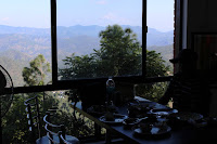
Two rooms were arranged at Lalkuan for freshening ourselves up and we started from Lalkuan at about 9.30 a.m. We took our breakfast an hour after in a road side restaurant from where we had the feast of eyes just down below.
|
|
|
Breakfast session |

|
|
|
Bhimtal |

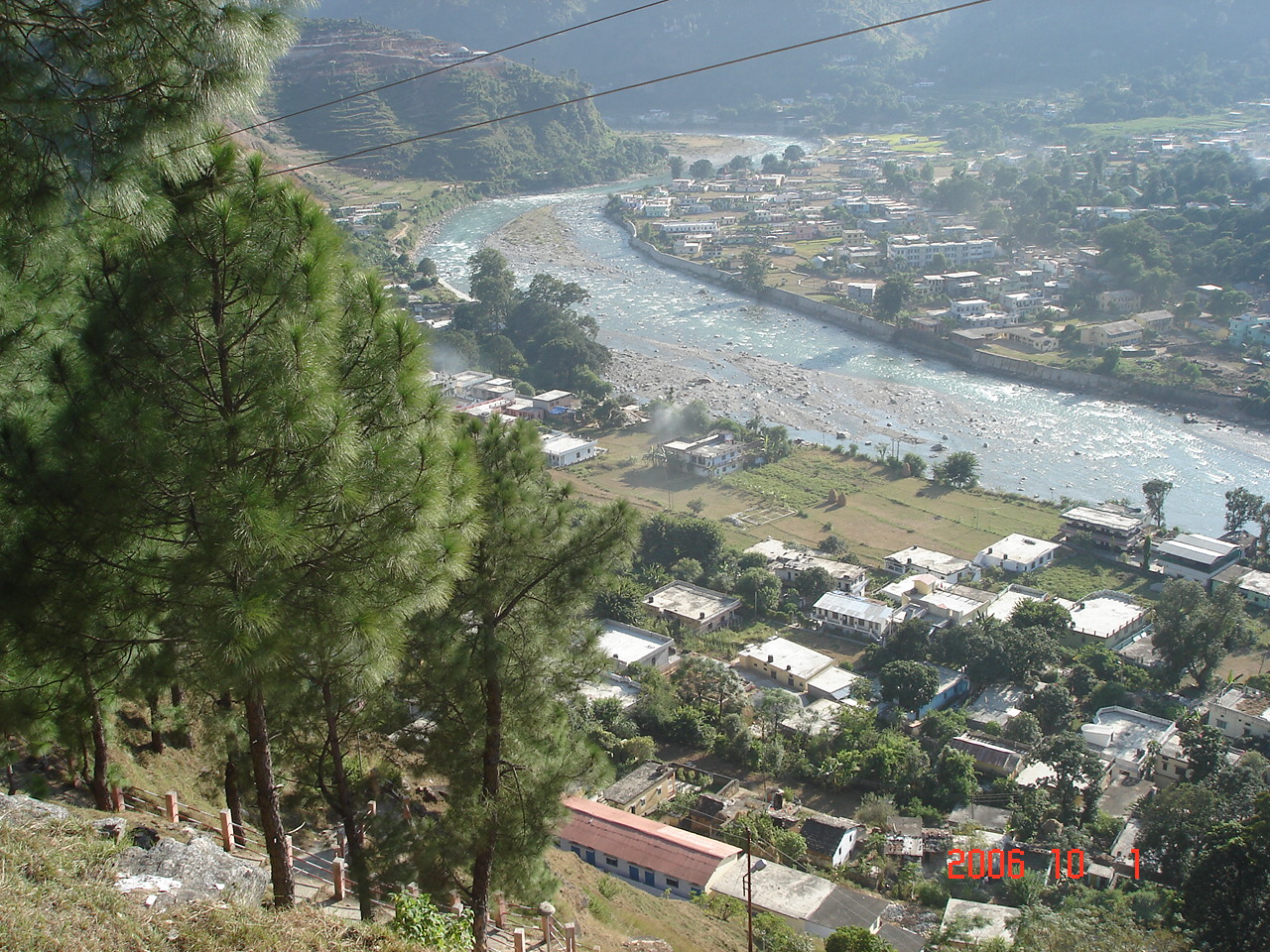
We passed Bhowali, Bhimtal on our way to Almora and reached Almora at about 1-30 p.m. Almora is almost midway of the entire journey of 192 km. from Lalkuan to Bageswar.
|
|
|
a glimpse through the car window |

We took our lunch at about 2-30 p.m in an another picturesque way-side restaurant.
|
|
|
Lunch Session |
Besides the usual menu in the lunch, Sharma took out from his magical trolley bag a container full of curd rice to add care and flavor of home.
We reached Bageswar at about 4-30 pm. We have had the booking at KMVN Tourist Rest house. Bageswar is a district head quarter town at an altitude of around 3300ft situated at the confluence of Gomti and Sarju river. Town is congested enough . The town does not attract ordinary tourist. But the trekkers of Pindari & Sundardunga glacier usually assemble here for logistic purpose. This may be the one of the reasons of absence of having quality maintenance at KMVN tourist rest house. After we settled at KMVN TRH, we had a stroll in the Bageswar town. We visited the Bagnath Temple which is situated in the middle of the town just across the confluence of Sarju and Gomti. The name of the town may presumably be given as such with the name of the temple.
|
|
|
View of Bageswar Town |
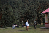
In the evening we sat with our guide Khilap Singh to have final discussion about our program and about dos & don’t’s during trekking . We learnt from Khilap Singh that Kafni glacier trekking route is closed as road condition is too bad . So after Pindari we will have two days at our disposal. Khilap proposed to go a new place 4-5 km from khati over a hill top from where excellent view of both Sunderdunga & Pindari glacier sides are available. Later on, this program was changed and we finally ended up staying at Dhakhuri Bunglow at the penultimate day.
|
|
|
View from Bageswar TRH |
2nd day (04.10.2015):Road journey from Bageswar to Kharkia and then trek of 5 km. to Khati ( Altitude 7300 ft approx)
The day’s program was to travel by vehicle upto Kharkia, a small hamlet on the traditional trekking route of Dhakuri- khati and then 5 km walk upto Khati. From Bageswar to Kharkia , it takes 4-5 hours journey due to terrible road condition. We started at about 9 a.m in the morning. We took our breakfast at Bharari. In 1982 we had to trek from Bharari itself . It too is situated on the bank of river Sarju and was a very small place with few huts only. But now it has grown into a small township.
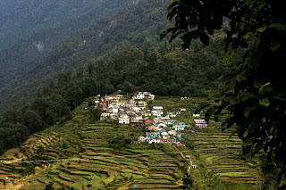
We had to wait almost an hour due to replacement of wheel in one of the two vehicles. Upto Bharari the road was somewhat recognizable as road. But after that there was no road as such. The movement of vehicle was painfully slow. We reached Kharkia at about 2 pm. Few dhabas were there in road-side. We took some food(may call it a lunch) in one such Dhaba. A downpour followed by hailstorm came before we started. It was heavy and nerve-racking. It made the whole scenario including our mood damp. Sky became cloudy and the rain made the trail slippery. We started trekking cautiously through the jungle of rhododendron and oak trees. The trail is a mixture of trekking uphills and downhills. The sky was overcast, so did not have the view of surroundings in our first day's of journey. On our return journey we got a clear sky and we had the excellent view of peaks in the Sunderdunga side. In particular the view of Panwaliduar was exotic. The 1st day's was not at all difficult. The distance was only 5 KM. We made it in two and half hours. Almost in the evening We reached at Khati, the last village in this route. The village has a population of around 500 with 70 odd house-holds. The main occupation of the villagers is cultivation. It has school upto class XI. For higher education one has to go to Bageswar. Streets are illuminated by solar lights at night. Most of the houses too do have solar lights. There exists two Kali Temple at the village.
We did not get accommodation in KMVN & PWD rest houses. In stead we stayed in a private lodge. As we completed the first day's programme without any hassle, we enjoyed the time before dinner together with a cheerful mood.
|
|
|
Our trekking started |

|
|
|
Khati village |
3rd day (05.10.2015):Khati to Dwali (Altitude : 8500 approx)Distance : Around 15 km.
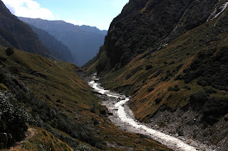
We had decided to start early in the morning as we all know that the day’s trek was going to be toughest. So we started at 7-15 a.m . The first half a km was through the jungle which seemed to be the remnants of the old trail. Actually if our old memory does not betray us then Khati- Dwali trail was the most beautiful one with most of it was through forest area. It was so until 2013 when a natural calamity (at the same time with Kedarnath catastrophe ) struck and the trail destroyed . While on walking we saw the trail within the jungle vanished suddenly and we found ourselves beside the raging Pinadri.
After few hundred yards again we had to climb up to the adjacent forest ridge through almost non-existance path on which barely a foot can hold on. Then again after 15-20 minutes’ walk we had to climb down to the river bed. This ups & downs continued almost half the way. Then climbing down to the river bed, we had the longest moraine detour of the trek. This section is the hardest part with huge boulders to traverse. We had to cross as many as four scissor bends and a distance of about 5-6 km on this stretch.
The path was all along rocky with large boulders strewn in all through. It was very tiring and exhausting . More so ,as this part of journey had to be negotiated at the later part of the day’s trekking, it was all the more difficult for all of us and when it seemed to us as never-ending , glimpse of Dwali TRH peeped in the horizon. Then again it got lost into the bend of the mountains. Almost after eight hours we finally reached Dwali .
Towards the left of Dwali lies Pindari Valley and the Kafni Valley is in the right side. Dwali is located next to the confluence of rivers. The magnitude of destruction due to cloudburst was evident. The old Dwali trail was barely in existence. The bridge was found to be broken. The Banks near Dwali washed away in multiple sections. In Dwali, other groups have already reached. Somehow we were accommodated in a room in KMVN TRH with only basic amenities. Not much change was visible with what we found in 1982. Maintenance was found to be poor. But we were in a great mood as we overcame the hardest part that day. First bite of cold was felt at night. After dinner we had a small flute session of old Hindi song by Sekhar and then we immersed into deep sleep with a happy note.
4th day (06.10.2015)Dwali to Phurkia (Altitude 10500ft)Distance : 5 km.
We were in a relax mood on 4th day morning. Some snaps were taken when sun rays turned the distant peak (Nanda devi East) into Golden yellow colour. We all enjoyed the moment.
|
|
|
Nandadevi East |

|
|
|
view from Dwali in the morning |

We started our trekking after having break fast at about 9 A.M. Although the distance is short , the altitude gain was around 2000 ft. There were patches of very steep ascent throughout the journey. At this altitude climbing up in the hill was felt by all of us.
The first part of journey was through the forest of mainly of rhododendron and it was the same route that we trekked 33 years back.
|
|
|
Our journey towards Phurkia |

Though most of the trail was quit o.k apart from occasional steep ascent, there was damage part too where we had to be little more cautious. In one occasion we had to negotiate a snow wall with great effort.
|
|
|
Negotiating snow wall |

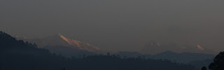
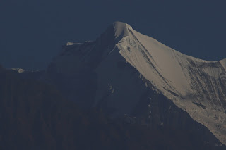
One thing is worth mentioning that all these days so far we have got excellent weather condition. So with the gaining of height, snow peaks became closer and larger. Gradually Nandakot peak was visible with its dazzling beauty.

As the trail was following the Pindari river, at times we did have a view of river flowing through the gorge down below.
|
|
|
quite flows the river Pindari |

|
|
|
Cloud cover over Nandakot |

|
|
|
Purkia Bunglow |

At about 1 pm. We reached Phurkia.
After reaching Phurkia , we found heavy rush due to accumulation of parties both onward and return journey. Our guide Khilap somehow managed one small room with broken windows and seemed to remain to be used only in dire circumstances. The room was just enough to accommodate eight of us. Of course the luxury was that the room had a fire place and during that night it gave us comfort to some extent. It was biting cold during night and our assumption was that the minimum temperature was close to Zero. We were to start at 4 A.M in the next day. So we were almost forced to go to bed at 8-30 pm.
5th day ( 07.10.2015)Phurkia to Zero point & back Distance : 12 km.
We started at 4-15 AM. It was pitch-dark . The period was in a new moon cycle. Only very thin defused light just faded the surroundings. Every body of us was carrying a torch light. Movement was slow and cautious. Nice to see the tiny dots of light moving along the hilly terrain in the sea of darkness. Almost an hour we had to go through this ordeal . We were above 10000 ft already , so large tree has already vanished. In place bushy trees were found to be scattered here and there. As lights slowly drove away darkness , the majestic surroundings started appearing into fore.
|
|
|
Nandakot at dawn |

|
|
|
First light on Nandakot |


One by one full horizon started to dazzle . Colour of Sun light of the peaks changed every moments. Every one of us started taking pictures . Every moment was precious. It is impossible for any word to describe the scenario , so let the pictures below talk.


Half the path still remained. Altitude has started coming into play. Most of us were just crawling step by step. We reached Baba Ashram one by one. We took breakfast there and decided to take a tea break only on return journey. The remaining part was the last lap of the journey. It was slightly above one kilometer. Actually what was Zero point earlier , that part caved in due to land slide. It is evident that the Zero point is not static now-a-days. It is shifting backwards as the day progresses. The last part was the traverse along a mountain terrain beyond which Pindari river flows deep down a gorge.
|
|
|
River Pindari |

Amongst us , who had visited earlier , were not delighted to witness the present-day-zero point. It was on a narrow ridge from where full view of the glacier and Trail’s pass was not available. That Pindari glacier has gradually been receding is well pronounced in the pictures taken during 1982 and on 2015 (shown at the start of the blog). The clear portion of the snout of the glacier (in the picture of 1982) has completely vanished from the scenario , may be due to the effect of global warming. When we reached zero point it was crowded with many other fellow trekkers of different groups gathered all the way from Mumbai, Bangalore , Pune. Everybody were busy taking photographs. We did it too.
|
|
|
zero point |

|
|
|
Zero point |

We stayed there for half an hour. On our way back we made a halt at Swami Dharmananda Ashram. Some of us visited the temple inside. Baba was kind enough to serve us tea. We made a photo session with Baba.
|
|
|
Swami Dharmanandali with us |

|
|
|
Pinari River |
|
|
|
Wild horse |

Returning to Phurkia was less arduous for obvious reason. It took only two hours to reach Phurkia. On the way we had taken many snaps which will add value to our photo gallery. One of the memorable shot was of one brave mother accompanying her two children returning from Zero point. What a unique way of baptism in adventure sports!
|
|
|
Brave mother with her children
|

|
|
|
|


Return journey :
Phurkia to Dwali (08.10.2015)
Dwali to Khati (09.10.2015)

After we returned at Phurkia , nos of trekkers were less . As most had left for dwali on the same day. From the beginning we had decided not to overdo at any point of time considering our age. We got another room that day and we comfortably stayed the rest of the day. In Phurkia itself after discussion with Khilap Singh, we decided to spent a day at Dhakuri TRH. In the next two days we did enjoy a great deal , taking rest, enjoying the beauty of nature, taking photographs etc. The trail between Dwali to Khati did not seem to be as harder in the return journey as we passed through the difficult portion in the morning iiself. We took some beautiful snaps in our return journey too.
|
|
|
Nandadevi east |

|
|
||
|
Nandakot on the return journey to Dwali
|


|
|
|
Khati Village |

On our return journey our stay at dwali was also comfortable and in the khati we stayed in a private lodge(Sangam) which is located in a better place and having solar lights too. In the evening we had roamed around inside the khati village, talked with the villagers and had tea. It was a wonderful experience.
The highlights of our return journey was of course staying at Dhakuri TRH. Dhakuri is located on the traditional / old Pindari Glacier trekking route. Now as road connection reaches Kharkia most of the trekkers prefer that route to save nos of days. But in the process this trekkers also miss one of most beautifully located bungalow in Kumayun Himalaya. We started from Khati at about 9 AM. The distance is around 8 KM.Another memorable incident during our journey from Khati to Dhakuri was the distribution of Musks & whistles among the village children of Khati by Sharma. Even on receipt of such small things (compare to children of city- dweller),the kind of glow seen in the face of those little children made everybody of us blessed and the moments will long be remembered by all of us. Bravo Sharma, kudos to you for offering us such a blissful moment. We had our lunch at Kharkia and left most of the luggage at Kharkia . From Kharkia, Dhakuri is only 3 Km. but the trail was mostly steep uphill, a good portion is through forest.
|
|
|
Kharkia to Dhakuri |

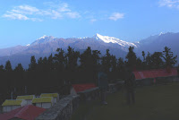
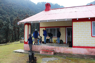
We reached Dhakuri at about 3 PM. Dhakuri TRH was not only beautifully located but it was also found to be best maintained amongst others in this route. It was afternoon and cloudy so we did not have any view of snow peaks that day. We were in festive mood. Bungalows were found to be scattered in a meadow. In the following morning we did have excellent view of snow peaks situated with a radius of 180 degrees. It is suggested while in the Pindari trekking one should stay a day at Dhakuri.
|
|
|
At Dhakuri |
|
|
|
View from Dhakuri |

We had enjoyed the view from Dhakuri Bungalow till 8.30 and started our last lap trekking to Kharkia.
|
|
|
View from Dhakuri |
|
|
|
View from Dhakuri |
|
|
|
Dhakuri Bunglow |
|
|
|
View from Dhakuri |

|
|
|
Panwalidwar |

|
|
|
Returning from Dhakuri |

|
|
|
Kharkia |

The rest part of the journey was a routine affair. We returned home as a mentally & physically healthy person.
Epilogue :
Looking back to our success story we wonder how we have come across as a winner against all odds. Probably because none of us, during the days of trekking, ever thought of his limitations , age , physical discomfort , inexperience etc. Those who were having experience of trekking , knew that it was always a tough call whether you make at 32 or in 62 but we had the mindset that we would not bother about the destination. It was the day to day journey which was most important to us. Our attitude was like that it was the repeat performance only with a time-gap. All the participants have contributed in successful implementation of the program. The mental frame was tough enough to make us thinking always in a positive way. May be it developed through our preparation for four long months. Thanks to our fellow members who though did not participate, always encouraged us all through the period. We were fortunate enough to have a guide like Khilap Singh and his assistants (eight in all). Their contribution were well felt whenever we faced difficulty on the way. We were lucky to have excellent weather condition throughout the days. Thanks to those who have chosen the period of journey.
To end with, all of us who participated, feel like it’s a new beginning……………………………….
Add new comment